When I hike or bike I always have my GPS. Even if I know the area I keep it turned on in my backpack – this keeps a record of my trip. Also, having the GPS track lets me easily geotag the pictures I take on the way. This post is a quick summary of what GPS tools I’ve found most useful for these common tasks.
The Map
I have the Garmin eTrex Vista Cx GPS unit. It came with some CDs containing a pretty good North America map. Pretty good – but quite outdated. Also – it was good mostly for driving around – things like hiking trails, biking alleys and so on were sadly missing from the map.
The best alternative of the Garmin maps I’ve found turned out to be also – quite surprisingly – absolutely free: OpenStreetMap. First, it has most, if not all, of the hiking trails in my area (this makes the map just great for geocaching!); second – there are places where you can get those maps pre-build in the Garmin map format without the need to install anything. Check the OSM and if you find the coverage in your area good, you can get the Garmin maps from here. For USA maps, the easiest thing is to get them already packaged and ready to upload from this site.
If the OSM coverage in your area leaves something to be desired, then maybe you would like to contribute – you can upload your GPS tracks and update the OSM map yourself.
Downloading and processing the track
While the software that came with my Garmin provided download options for track data, it was a bit on the heavy side – taking too much time to start, and – if I was going to use it just to download a GPX file – it was too complicated. A very handy alternative that I use is EasyGPS. Very fast, very simple, and to the point.
After downloading the track I save everything as a GPX file from EasyGPS. If I have to edit something on the track (like trimming the part of the track where I was driving, and leaving just the hiking part, or removing those annoying jumps that the GPS sometimes makes when the signal is not good), I don’t like using EasyGPS. Recently I found an alternative that I like better for such minor editing tasks: GPS TrackMaker. The free version has everything I need.
Geotagging pictures
You know that feeling when looking at old pictures: “Where was this taken? Was it on the Rockies trip, or maybe is that nice park in Seattle?” Geotagging (geocoding) a picture puts the location information straight in the image file – you can always extract it and see exactly when and where it was taken. A lot of online galleries – Picasa and Panoramio for example – recognize this geotagging information and can display a map with your pictures at their exact spots.
The easiest (free) tool for geotagging images I’ve found is gpicsync. Make sure your camera clock is synchronized with the GPS, start gpicsync, provide the pictures folder and the GPX file with the track from your trip, check if the timezone offset setting is correct and press “Go”. That’s pretty much it. You can later confirm that you got your pictures coordinates right by viewing the KMZ file the gpicsync produces in Google Earth.
Posting your trip online
As I mentioned before, many online picture galleries already make use of the geocoding information in your images. I’m not going to cover those. Rather, I’ll mention one site I discovered just a few days ago: EveryTrail. Uploading a GPS track there produces a nice animated map and a page with statistics about the trip – length, average speed, etc. Here is one of my recent bike trips – a 31-mile loop from San Jose to Los Gatos (please, don’t laugh at my average speed – I’m just a beginner in mountain biking; so, most of the time I was pushing the bike uphill – ok, you can laugh now).
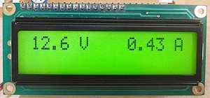 Here is something I’ve been looking for for a while – a simple and versatile PIC-microcontroller-based voltmeter/amperemeter. Of course, there are many similar projects, but this one fits my requirements best. It is simple to build and not picky when it comes to the need of high-precision resistors, because of an easy calibration routine.